Driving Our RV in Europe

The most frequently asked question we get from Americans about our experience motor homing in Europe is how difficult is it to drive? Our quick answer is it’s easy, tens of thousands of Europeans do it every year. Our experience is that driving in Europe is different then in the US, but not so different that you should not visit Europe by RV.

Statistically fatal accident rates in Western Europe are less than half the rate of the US. The worst country in Europe is Bosnia with an automobile fatality rate of 15.7 per 100,000 people compared to 12.4 in the US. Italy which has a reputation for aggressive driving has a fatality rate of 5.2 per 100,000 which is less than half of the US.

The rest of this post gives our impressions of driving in Europe based on our limited experience.

Roads

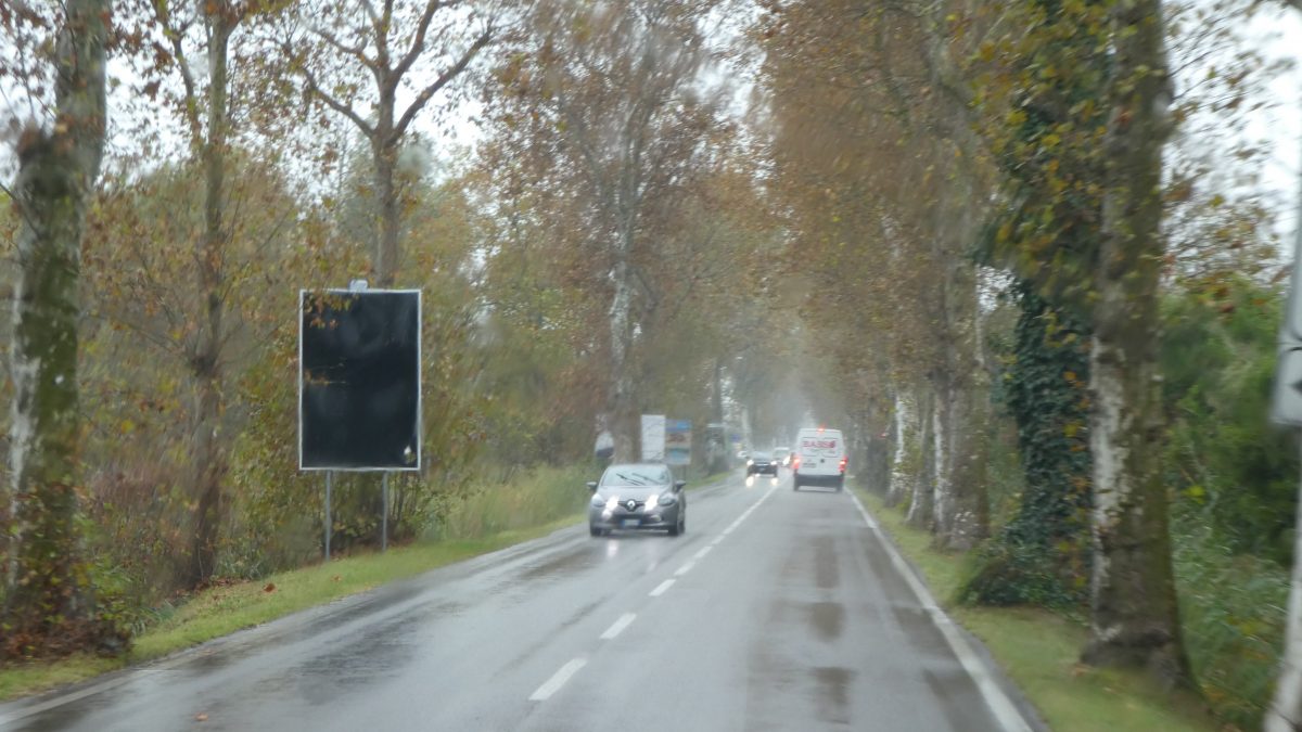
The roads in Europe are generally very good. There is as you would expect some differences in quality from country to country. German roads were exceptionally good, better than the US. The worst roads were in Italy, especially Sicily, but they were not so bad that they required a high level of awareness. Our impression is that the standard lane width in France is narrower than in other countries in Europe and certainly the US, which is my only complaint about French roads. Driving between cities is generally very easy and no more stressful than in the US. In fact in Spain and France traffic is often much lighter than in the US on equivalent roads.

The biggest difference in European roads is in cities. Because of the age of the cities, many urban roads were laid out hundreds of years ago and therefore are narrower than modern roads. In cities parking is much tighter than in the US and sometimes spills into the traffic lanes. We find urban driving is more stressful than at home because everything is just a little bit tighter, and sometimes quite a bit tighter.

Update 2023. Since I wrote this we have gone to Portugal, and the Balkan countries (Slovenia, Croatia, Montenegro, Albania, Greece, Bulgaria, and Romania.) The toll roads in these countries are also generally very good. The secondary roads are not particularly stressful, though some of the mountain roads in Montenegro and Albania were narrow and a little rough, but fortunately traffic is pretty light. Romania was a bit of a challenge as a lot of the time you are traveling thru small villages with low speed limits. Travel time was longer in Romania than most countries, but the roads were of a good quality. We had no particular problems driving in these countries.

Types of Roads

Generally speaking in the countries we have traveled there are three categories of roads. The nomenclature is not standardized so for my ease I am going to use the French designations. You will quickly learn the local term for each type of road.

Freeways/A roads

Autoroutes in France are designated with an A and number (sometimes E if it is considered a trans-Europe route). These are the equivalent of our Interstate highways, though in many countries (except Germany, the Netherlands and Belgium) they are tolled. The quality of these roads is extremely good. There are frequent service areas that do not require you to leave the highway to use them. While the service areas are convenient the cost of fuel is quite high, and we have never fueled there for this reason. They often will have a restaurant and of course restrooms that are usually free to use.

Typical A road leaving Italy for France.

The level of traffic is often less than we are used to in the US, particularly on Sunday when commercial traffic is restricted. If you are planning a long jump in Europe Sunday is a particularly good day to do it, as most stores and sights are on restricted hours so there is not much to see, and truck traffic on the A roads is very light making travel easy.

One difference is that many of the A roads are monitored by surveillance cameras, so help is automatically dispatched if an accident or breakdown occurs. Also, speed is monitored by camera systems in most countries. It is rare to see a police vehicle writing a ticket on the shoulder as we are used to. Instead a fine shows up in the mail a week or two later when you trigger a camera, and the police concentrate on other things. Don’t ask how I know this!

The speed limit on A roads in rural areas is usually 130 kilometers per hour (80 mph) for light vehicles, generally defined as under 3.5 tons. For heavier vehicles the speed limit is 90 kph (55mph). In urban areas the speed limit usually drops to 110kph (68mph) for light vehicles and stays at 90 kph for heavy vehicles. Many RV’s (including François) qualify as light vehicles and can use the higher speed limits. We do not recommend you drive a RV at 130kph. We normally drive between 95 and 100 kph which on Sunday makes us one of the slowest vehicles on the road. Another thing to note is that the speed limit automatically drops to 110kph in rain and fog.

While passing on the right on interstates is technically illegal in the US, it is rarely enforced. If you read Europeans writing about driving in the US they are shocked that we do this. Passing on the right is enforced in Europe and never done. Because of this lane discipline is good. Slower traffic stays to the right, and only uses the outer lanes long enough to pass and then move immediately to the right again. This is actually quite refreshing and makes travel easier.

The A routes in Germany, the Netherlands and Belgium are free. Also, a significant portion of the Spanish A routes are free, but not all, and some of the sections we traveled in Italy were free, particularly in the south. When tolls are in place they are quite expensive, particularly in France.

When we first began traveling in Europe we tried to avoid the A routes completely. Our first two trips were limited to France and we wanted to avoid the cost of the A routes. Also, the A routes like the interstates in the US really isolate you from the countryside and we miss the little things you see when you travel on regular roads. As we spent more time there we began to use the A routes more often, particularly when we were making longer drives to change regions. Now we evaluate the convenience of the A routes vs the cost. Also, in Italy we defaulted to A routes as the secondary roads were less well maintained and stressful on me and François.

Vignettes

Many countries in Europe use a system called Vignettes instead of toll booths on the A routes. These are passes that you purchase in advance and display in your vehicle. For residents and frequent visitors an annual vignette is offered. Many countries offer transit vignettes for shorter periods of times either weekly or monthly. These days vignettes are mostly purchased on line which is very convenient. You enter your vehicle plate number, the dates you intend to be in the country, and a credit card number. They then use cameras to monitor your movement around the country. Make sure you get the date right. We arrived in Bulgaria one day earlier than the date I had put in the computer and were fined more than the cost of the 30 day vignette we had payed for. We also did not get a refund for the 10 days we did not use!

Portugal has a mixture of normal toll roads, and toll roads that require you to be pre-registered in an e-vignette system. Keep that in mind when visiting there.

Determining if a country requires a vignette can be done with a simple Google search, as well as the types and cost. If you opt for a larger RV (above 3.5 tons) some countries require an electronic device that monitors actual miles driven and charges based on that. In the past you purchased a sticker to display in the windshield of the RV, while we used this method in Austria, an on line one was available. Most countries make it very easy to acquire the vignette if a physical one is required and frequently they can be purchased at gas stations.

In many countries the vignettes only apply to the A roads, so if you stay off of A roads you do not need to purchase one. However, Bulgaria requires a vignette for all non-urban roads, so do an internet search before arriving in a country.

Highways/N Roads

N roads are referred to as National Roads in France. The designation N is the French designation and the letter does vary from country to country but all of the countries we traveled in had these type of roads. They are the old main highways prior to the A Roads and are analogous to US Highways. They are designed to handle semi-truck traffic so are generally wider and have shoulders. Occasionally they will have two travel lanes in the same direction, and less frequently they will be limited access. They are always free of charge, and in countries that charge to use A roads a reasonable free option has to be provided by law, and these are frequently the N roads. The N roads are more likely to by-pass towns and villages than D roads. The speed limit varies more on these roads than others, but is usually 90 kph in non-urban areas. These roads are frequently very good alternatives to A routes allowing you to see more of the countryside while making pretty good time.

Local Roads/D Roads

D roads are the most common road. They are the equivalent of our state and county roads and you will spend most of your time on them as most of the good sites are located on them.

D roads are by far the most variable in quality. The pavement is usually good, we have only come across poor pavement very occasionally, the real variation in quality is in width. They range from very occasional limited access roads, to one lane roads with pull outs.

Two lane D road typical in France between smaller towns.

These are the roads that connect small towns and villages to larger towns. They also are the roads that cut thru towns and villages so you will find yourself navigating these small towns. Most of the time it is no problem except for slowing down for the lower speed limits. Occasionally you will run into a tight squeeze.

The default speed limit on these roads is 90 kph (recently changed to 80 in France). The thing is that it is 90 whether the road is a good two lane road with shoulders, or one lane with pullouts. Your average speed if you follow these roads for a long period of time will be well below 90. We plan on an average of 60 kph on these roads.

The D roads are worth it for views like this.

We do our best to avoid the very narrow roads, but of course we do not know the area we are driving in, so are not sure if the tiny road our GPS is guiding us down has a better alternative route that is slightly longer but faster. We tend to follow the GPS directions less regularly in Europe than in the US. If the road Greta our Garmin tells us to turn down seems very narrow we will continue along the larger road we are on and see what happens when she reprograms herself. So far our instincts to avoid narrow roads has worked pretty well.

However, sometimes you will find yourself on the one or one and a half lane roads. We just look as far ahead as conditions allow, and when we see on coming traffic we look for a wide spot to pull into. Most of these roads have small pull outs strategically placed to allow for this. There is a great deal of farm machinery using these roads and they are quite wide. The farmers are very good about moving over as much as possible to allow you to squeeze by.

A one and a half lane “D” road in Spain. There will be periodic wide spots to allow large vehicles to pass each other.

Our last advice is when you do get into a tight spot do not panic and take your time working out the best solution. Our experience is that almost everyone is very patient while you and the other vehicle pull in mirrors, do some hand signaling and get it sorted out. Everyone takes the slowdown in stride as it comes with the territory.

Urban Driving

By far the biggest difference between Europe and the US is in built up areas. Villages, towns and cities have road infrastructure that pre-dates automobiles. In the US while cities may have more going on around you, the traffic lanes remain at the standard width we find on our highways. In Europe by necessity this may not be the case, so you have all of the distractions that come with urban situations, (pedestrians, cars popping out of parking etc), you are often doing it on a less than standard width lane.

An urban road in Greece.

The distance between buildings and the road can be much tighter than we are used to. This can come into play particularly when you have to make a turn with a building right to the edge of the road. This tends to happen most often in small villages. It is difficult to see if there is something on the road you are turning onto and there is no buffer so you may need to swing a little wider into the on coming lane to miss the building. There often are mirrors in place on these turns to allow you to see if there is traffic coming. If you are turning from one of these roads to the main road it may be blind for you and you have to creep a little to see if there is traffic coming. My best advice is take it slow in these cases.

While it is best to avoid these roads sometimes it cannot be helped.

Often for large and mid-sized towns there will be by-passes for commercial vehicles. Your GPS may be sending you thru the town, use the by-pass as it will ultimately be faster and less stressful.

This sign is the city limit sign and means that the speed limit is 50kph unless otherwise marked. The exiting the town sign is the same with a slash thru it.

The speed limits are 50 kph as soon as you pass the city/town limit sign, and it is often enforced with a speed camera. While people may cheat on speed limits a little outside of towns, we have seen very few people cheating on the speed limits in town. As you approach the very center of the city the speed limit often goes down to 30kph.

Traffic Circles/Roundabouts

Traffic circles are much more common in Europe than the US. The French in particular have a fetish like attachment to them, and are actively building them all over the place. As we became more used to them we began to appreciate them, particularly in the countryside. In low traffic areas they are a much more efficient way to handle cross traffic. On a N or good D road in France you will encounter circles very frequently, it is rare to go more than 5 or 6 kilometers between circles on a well traveled road.

Typical Circle in Europe.

In cities they can be a little more stressful as the traffic volume is higher and the traffic may be entering the circle in multiple lanes and the circle itself has multiple lanes. Our method to handle busy circles is to enter the circle in the right lane and stay there until we get to our exit, and exit into the right lane. This allows people to do whatever they have to do while we move along.

Europeans use their turn signals to indicate if they are staying in the circle, (left turn signal), or taking the next exit from the circle (right turn signal). Signaling is very important in the busy circles as it lets people know you are continuing around if they are exiting the circle or trying to enter the circle. This is probably the best safety tip I have for handling circles. In the busy circles people will cut in front of you to exit, just expect it and accept it.

One trick I learned from a British couple was that circles are a good way to lose the tail of cars you will accumulate being one of the slower vehicles on the road. When you enter the circle, by pass your exit the first time and go all the way around the circle. It is a courteous way to allow the cars behind you to get in front of you without having to pass you on the narrow roads, and delays you only a few seconds.

Traffic Lights

Traffic lights in much of Europe are quite different than the US. They are much more austere. They are usually placed on the corner of the intersection they control, and there is only the one light. The large light that you key on as you approach the intersection is angled down the road it controls, but if you are one of the first cars at the intersection you will not be able to see that light. A smaller version of the light is located about half way down the pole and is angled so the first couple of cars can see it. It is important that you not overshoot that small light as you will have no way of knowing when the light changes until someone blows their horn at you.

A typical French traffic light. The large light at the top is visible down the road, the small light at the bottom is all you will be able to see if you are the first vehicle at the light

Toll Booths

In the countries with Toll roads they all have done a very good job of providing enough booths so that traffic is very rarely delayed. So as you approach the booths you go from 2 or 3 lanes of traffic to 10 or 12 lanes of traffic with all of the slaloming associated with people trying to get to the correct lane and shortest line. We find it is not too bad, we identify the correct lane for us, and head in there watching for people angling across our path.

On entering the tollway you will be directed into a booth that dispenses a ticket recording where you entered.

Typical toll station in France, the French have recently added height barriers on some of the lanes to keep things interesting for RV drivers, keep an eye out for them.

The trick is identifying the correct lane. All European countries have an electronic system available that seems to be universally called Telepass, but each country administers it separately. Telepass owners pass thru the booths without stopping and the toll is added to their accounts. You have to avoid these booths as the fine is quite substantial if you inadvertently pass thru one of them.

Telepass lane on left, Credit Card lane on Right.

We pay our tolls with credit cards and the lanes that accept credit cards are marked with a sign that looks like the back of a credit card so they are easy to identify. There are usually one or two booths that take cash if you do not want to pay with a credit card. We have heard stories of toll booths refusing to accept non-European credit cards. In our two years of driving we have not run into that problem.

Typical pay station.

The payment system is pretty straight forward. Insert the ticket you received on entering the tollway. Insert your credit card, and if you want a receipt push the button for the receipt. The gate should then go up and you are on your way with a recorded Arrivederci in Italy, and silence in other countries.

The pay stations usually are set at two heights, one for cars, and the other for commercial trucks. The one inconvenience is that François our RV is right in between the heights and I usually have to put him in neutral and remove my seat belt prior to engaging with the station. It can be a little bit of a scramble to get the belt back on once the gate goes up.

Limited Traffic Zones

Many cities in Europe have limited traffic zones. They are usually in large urban areas. Each country administers them differently where they exist. The guide books usually have information about what cities have them and what they are. This has not impacted us very much because in large cities we prefer to stay on the edge of the city and use public transit, so we are usually outside the Zones.

A limited traffic zone with hours it is in effect posted.

The one exception to being able to avoid Limited Traffic Zones for us was Italy. Fairly small towns had them. We ran into one in the town of Tropea which threw us for a loop until we figured out it was not in effect at that moment. The key thing is not to blunder into one as the fines are substantial if you are caught. When one is imminent there is usually enough warning to turn short of the Zone and regroup. Campgrounds and Aires will not be located inside these for obvious reasons.

Manual Transmission

Most RV’s in Europe are equipped with manual transmissions, and while newer RV’s are touting automatic transmissions the market is still overwhelmingly manual. Finding a used RV with an automatic transmission is going to be difficult.

Since manual transmissions make up less than 3% of car sales in the US most of us are either rusty or unfamiliar with sticks. I found that I adapt pretty quickly to shifting when I am there, the years of shifting gears from my youth come back to me. I will confess to finding no joy in shifting gears and miss Scouts automatic transmission. If I was buying new I would definitely spend the extra cost to buy an automatic.

Signs

The signs are different than the ones we tend to use. There is overlap such as stop signs, but most are different. Having said that they are normally pretty intuitive. Because of the many different languages in Europe they use symbols only, and very rarely use words. The signs are standardized across Europe.

All guide books have a list of road signs in the back if you come across one you cannot figure out. There are some fairly obscure signs that may require Google to sort out, but they are generally not too important, but informational.

The only time we have gotten into trouble with signs is when they contained local language. In France we would often see speed limit signs with the word Arret under it. I took this to mean ahead, like the signs we have in the US warning you of a lower speed limit ahead. After about 3 weeks I googled the word, and it really means now, the opposite of what I thought. Our experience are signs are not a big issue, and you will adapt your eye to pick up the critical ones.

Our best advice before you leave is (re)learn to use a manual transmission, and spend a few minutes looking at the traffic signs on line so you can get a feel for what you are getting into. The first day I would keep the trip drive short so you can get a feel for the roads and the RV. If you are in France you will almost certainly have your first experience with a circle/round about, just remember to use your signals as we are not used to that as Americans. And finally enjoy, it is part of the fun.

In Trip Planning

What is that place, and where can we stay?

In a previous post we talked about the planning we do before we depart for our trips to Europe. When people ask us how we decide where to go on the trip we usually answer that we do not. Our daily planning is fluid, but it is based on our trip highlights we set prior to departure, so while we do not have a set itinerary we do have 6 to 8 must see places that drive our decisions on how to proceed every day. This post talks about how we select places we go to next, and the thoughts behind those selections.

We are type A travelers. We tend to move very frequently as we have not learned to enjoy, like so many other travelers, the pleasure of sitting and chilling. After a couple of days in one place we are looking to move on. For this reason we are constantly scouting for the next spot we want to see. This does not mean we will not spend 4 or 5 days in one place, but that is an exception for us.

This means that nightly after dinner we are looking for our next stop on the route. Our unofficial target in Europe is someplace that looks interesting within 100km’s of where we currently are.

Picking the Next Stop

The obvious first step is to look at where we are now. Is there anything else we want to do in the town we are in, if not it is time to move on.

We begin by looking at what other towns are in the region we are in. We carry two travel guides with us on every trip. Ton tends to favor the DK travel books for countries, and prefers an actual book as it allows her to read while we are driving. I also download the Lonely Planet Guides for the country we are in on to my Kindle. The Lonely Planet books are currently available on the Kindle Unlimited Service for the monthly charge for the service. Both DK books and Lonely Planet offer road trip books for major European countries and these are Ton’s favorites as they match the way are traveling. Also, while the theme of road trips is the same, the trips themselves do not always overlap so having two guides gives us more options. These guides often give us some ideas for a series of towns to visit.

Another important source is other travelers we meet. Quite often in the evening we will have conversations with our neighbors and inevitably favorite places come up. People will often tell us not to miss a place so we will add it to the list of places to try to get to.

When we first arrive in a particular region we will try to gather some tourist information at the normal sites, tourist information offices, campground information desks, and big tourist sites. We sometimes consult these for ideas.

After the next stop is selected we divide up the work. I work on finding a place to stay and selecting a route. Ton begins to do more research on things to do in the town.

Check the Weather

We also check the weather for the day as that will have a big impact on our plans. At least twice during our travels we have re-routed ourselves because of the 10 day weather forecast. Even if the weather is not going to change our destination we need to know what to bring with us when we leave François for the day, and it effects the places Ton selects to go see.

Selecting a place to stay.

I begin by consulting our go to place to stay app which is Park4night. Park4night is available on the Apple app store, and there is an android version of it. Park4night is a database of places that other campers have nominated for stays, the app owner has a group that then goes out and verifies the suitability of the site if there is a question. The database includes campgrounds, aires, parking lots where overnight stays are tolerated, and wild camping sites. It also lists parking lots that are not for overnight stays but can accommodate RV’s for day trips. One of the features I really like is that after you input the town you are interested in going, there is a map available that gives you an overview of all of the sites in the database keyed to what type of spot it is. This feature gives me an immediate feel for where the different options are located.

When looking at options for places to stay I tend to look at the options in this order, Aires, Campgrounds, and lastly free places. This is a very personal choice, and we run into many RV’ers who pride themselves on maximizing their free camping time.

A Spanish aire near Gibraltar.

I then look at the options for aires first. If there is a good aire and we do not require a campground I usually opt for the aire. Our priorities when selecting an aire are:

  1. Close to the sites we are going to visit.
  2. Price. Aire sites vary greatly in price from free to as much as €20.
  3. Convenient to transit. This priority goes up if we are having to stay away from the sites we want to visit.
  4. Secure. Park4night gives user reviews, and since it provides a pretty good automatic interpretation of most languages it is widely used by many nationalities. We primarily look for security problems in the past, and high noise.
  5. Service points. Many aires provide dump stations and water. A few provide electricity. Depending on the state of our services we may pay for an aire that has this rather than stay in a free aire that does not.

As a minimum every 3 or 4 days we stay in a campground, and after our last trip to Italy, Ton is beginning to think we should prioritize campgrounds over aires. If we decide to stay in a campground I will also consult the ACSI app as well as Park4night. ACSI is a campground service somewhat like GoodSam in the US. For a small fee (€20 for 2020) you gain access to discounts at campsites particularly during shoulder season. Typically with ACSI we pay €16-20 per night. The card pays for itself very quickly and I highly recommend joining. They will send the membership package to your home in the US.

For Campgrounds we have a similar priority list:

  1. Close to the sites we are going to visit.
  2. Price.
  3. Services available. We prioritize electricity and WiFi. Some campgrounds offer on site restaurants and bars but those are not important to us.
  4. Laundry room. Finding good laundry rooms is an eternal search for RV’ers. If the reviews specifically call out good laundry I will let Ton know.

Our lowest priority is free camping. We are very conservative in selecting this option, though I would guess we spend about 10% of our nights in free parking spots. If a city is offering an aire for a nominal charge, we respect that and will forego free parking 100% of the time. We feel that we should support the municipalities effort to provide the aire. Park4night will list sites that people have spent the night in parking lots or even on the side of roads. In many parts of Europe this behavior is tolerated for short periods of time if you show no indication of “camping behavior”, which means no level blocks, no awnings, and certainly no chairs.

Our priorities for free parking are simple.

  1. Close to the sites we are going to visit.
  2. Security. We are very picky about this. I am looking for a site that has been reviewed many times on Park4night, with no security incidents and no indication that the police have ever asked anyone to move on.

If we cannot find any suitable places to stay using Park4night, and ACSI, I will consult another app called Campercontact (also in the Apple app store) and I will run a Google search for campgrounds. In a couple of cases we found sites that were not listed on Park4night by doing this.

Occasionally good sites are not available close to where we want to go. One example was Barcelona where we did not find a site we liked in the city and ended up staying about 30km’s away at a campground that offered a free shuttle into the city. Once in a while after I do a search and cannot find a site I like we end up changing our plans. This happened in Nuremberg Germany.

Once I finalize a place to stay I note the GPS coordinates for the site. We nearly always use GPS coordinates when navigating in Europe, as we find Greta Garmin our GPS system prefers them over addresses. There are three systems for GPS coordinates and I prefer the digital method. If the GPS coordinates use one of the other methods I convert them to digital coordinates by using a website called LatLong.net.

Planning the Drive

Often planning the drive is as simple as plugging the coordinates into Greta Garmin and going to sleep. For short drives that is often all I do. Occasionally we have to take longer drives and I want to look at alternative routes. For longer drives in countries that charge tolls we often will look to see if we should take back roads or go ahead and pay the tolls.

When faced with this decision I look at two apps to decide which way to go. The first is an app called viaMichelin. It is a road map application that allows you to input the size of your vehicle. You can also filter the route to allow tolls, freeways, and ferries. I like this app because unlike google maps which has all of the other capabilities of viaMichelin it has very up to date information on the cost of tolls in Europe. As this is often the key decision maker for us on long trips we often start with viaMichelin.

I will often review the turns for the last few kilometers of a trip on Greta when we are heading towards parking in the center of cities. Our experience is that this is when Greta tends to send us down roads best avoided in a RV. After reviewing if I have any questions, I will double check with Google Maps as you can often see the width of the roads clearer on that app using the satellite view.

Visit Planning

While I am researching where to stay and how to get there, Ton is researching what to do at the next place. She often does this research after I go to sleep as she tends to stay up later than I do.

She already has a very good idea about what is available from her country book. She then digs into the details about the town using the internet, and following up on recommendations she has gotten from other travelers. When I wake up in the morning she will often hand me a short list of things we need to do. She will also tell me if there is an interesting restaurant, brewery, or winery we should plan to visit, or if we are eating in for the day.

Auchan is one of the major grocery chains in Europe and often has a gas station attached.

Logistics

The final driver in our daily plans are the state of our logistics. Do we need diesel, propane, water or food. Do we need to dump our tanks and we cannot do it before we leave in the morning. Sometimes we are at a point where we may need something but not critically, and will adopt a if we see a place while we are driving we will swing in plan. Then if we do not see the place, the next day we will have to build finding whatever we need into the plan. We may have to research the location of a source of fuel, food, or propane. In general the cheapest diesel is located at grocery stores so the real homerun is when we find a large grocery with fuel. Fuel and groceries are easy and a simple Google search will give you locations for those places. For propane we sometimes use an app called Stations GPL to locate places we can fill our tanks.

With all of the planning complete we set off on our adventures for the day.

Pre-Trip Planning

Over the years we have learned that the more we prepare for the trip before we leave, the more freedom we will have to improvise our day to day plans. In this post I will talk about the process we use to plan our trips, and some of the tools we use to help us get everything organized. We are not list planners, but over time we have a general method that we use to help us and hopefully some of this will help you if you decide to try a RV trip to Europe or anywhere else.

This planning process presumes you already have a RV in Europe or have arranged a rental. The process we followed to purchase our RV is outlined in our post about Purchasing a RV in Europe.

General Planning

We are not full timers and the planning process for that would be much more complex than ours. For us our year is focused around two major trips to Europe. These trips are each around 60 to 70 days, but that is a significant time away from home and does require a good deal of planning.

Our process begins near the end of our last trip of the previous year. As we are driving around we begin to discuss what we learned on the last trips and places we are interested in. We take into consideration things like our experience during the last year. Interests that we have in places, and places that fellow travelers we met during the last year told us they enjoyed.

We also have a general rule that we go north in the spring, and south in the fall. This is driven by temperature. For a lot of reasons we travel during the two shoulder seasons when the weather is less predictable and of course in the spring we expect the worst weather at the beginning of the trip, and the fall the worst weather should be at the end of the trip.

Once the general plan for the trip has been settled we move on to more specific planning for the spring trip. For North America the trips are more spur of the moment and often revolve around going to visit our sons or friends around the country. We sandwich some other stops around our drives to the home towns of our friends or sons.

Trip Research

Once we have settled on our general plans we begin to do more research on our destinations. We gather some material together on our destinations including books, maps, and tourism websites.

Books

We still like to use books in our planning. Ton favors the DK book series. For major tourist destinations they will publish a general book on the country plus a road trip book. She likes the road trip book if the country has one. She will take the book with her on the trip as she likes to use the driving time to look at things to do around where we are. She also likes the map that DK provides with their books as a planning tool. I generally down load books onto my kindle and favor the Lonely Planet books as they are available on Kindle Unlimited which allows you to have 10 books downloaded for a small monthly fee. We both spend some time with these books getting a general feel for the countries we are visiting.

Other Travelers

We also take into consideration places other travelers have enjoyed or not enjoyed. We are fortunate that a lot of our friends also travel extensively so we can ask them what their experience was in the countries we are planning to go. We also take into account the experience of other RV travelers we have encountered in our previous trips. Another source of information that we tap into is travel websites, both the traditional ones and sites of other RV travelers.

Country Highlights

After we have done our research we come up with a list of must see places. We try to keep this list short, generally 6 or 8 places. This is the most important step as it drives the planning process for the rest of the trip. The reason this list is so important is it determines our overall route for the trip. This route is somewhat general, but gives us a guide as we are making our daily plans. By keeping the list to 6 or 8 places it allows for a great deal of flexibility in our daily travel. And while this seems like a short list for a 8 or 9 week trip we have yet to have a trip where we have not had to have a meeting where we decide which highlight we are going to drop.

Rome one of the travel highlights on our Italy trip.

Route Planning

The next step in our planning process is to set a general route for the trip. This is not a day by day itinerary. We use this to look at overall route options, some of the things we look at are:

  1. Will we be able to use a loop route without doubling back in any places.
  2. If we have to double back can we see different places going and coming.
  3. Are there any mountains or large bodies of water we need to cross that could be affected by weather.
  4. Are there any major festivals we want to avoid or attend.
  5. Do we have any commitments to meet friends that will affect our route.

To determine the best general route we use a tour map of Europe and highlight our must see places. Then taking into consideration the list above we decide on a general direction we will take from our starting point and have a planned order we will visit the “must see” places.

We try as a rule to avoid snow! But it always does not work out.

Weather Considerations

When looking at our general route we try to take weather into consideration. As we travel mostly in the shoulder seasons we figure that we may run into bad weather at least part of the trip.

We especially look at when we may be in the mountains as while François can handle cold pretty well, we do not want to try to do any real driving in the snow in him. We also look at any sites that really require good weather to enjoy and try to route ourselves in a way to make sure we are there when we have the best chance to have good weather.

Check out Ferries

One trick we learned on our last trip is when the trip does not lend itself to a circular route like Italy, look into the possibility of a ferry to or from the furthest must see place. This worked very well for us in Italy. There is a very extensive ferry system in the Mediterranean and the Baltic, and they are often quite affordable.

As an example we took an overnight ferry from Toulon France to Sicily for €255. This fee included François, the two of us, a private room, and one meal. This allowed us a great deal more time to explore Italy by only having to travel in one direction. It also saved us money, if we had driven that distance directly we estimated the total cost would have been higher taking into consideration fuel, food, overnight stays, and tolls.

We use the www.directferries.com to look at ferry options. It is not a particularly user friendly site as it presumes you know the name of the exact town that the ferry starts and finishes in. It is also not good about giving you alternate dates, many ferries do not run from both destinations daily, so if you get a ferry not available, try the day before or after to see if one shows. When using this site I keep Google maps open on another screen to double check the ports. While we never pre-book campgrounds; we would recommend you pre-book long distance ferries.

Schengen Considerations

As we are not trying to full time in Europe and plan our trips around the shoulder seasons Schengen does not have too much of an impact on our planning. In fact Schengen is part of the reason we choose to travel during the shoulders as it maximizes our time with good weather. If we traveled in the summer we would be guaranteed good weather, but we would probably end up with less time in Europe per year unless we wanted to travel there in the winter.

We time our spring trip for early April to early June, and our fall trip for early September to early November. Usually the April date is no issue with Schengen, but we did run into an issue last year for our fall trip. Because we had to take care of some business in early April we did not arrive for our spring trip last year until late April. We stayed about 60 days. When it came time for the fall trip we had some doubts about our arrival date so we began using a tool to calculate the earliest date we could arrive and have our full 90 days. The tool is published by the EU department of Migration and Home Affairs and is called a short stay visa calculator and is available at www.ec.europa.eu. This tool allows you to input the dates of your last trip, and the dates you are planning to come for your next trip. It will then display how many days you can stay on your upcoming trip.

A beautiful campground in Italy.

Camp Grounds

We do basic research on our must see cities for camping availability just to see how easy or hard it may be for us. For some cities you will find camping is easy, and others may require parking in the suburbs and taking a train in. We do like to spend a couple of nights per trip in a hotel so in the cities where it may be more difficult to camp we consider the possibility of using a hotel.

We use a few apps for both our pre-trip and in trip planning. We tend to lean on an app called Park4night. It lists all forms of camping including campgrounds, aires, and free camping. There is another app called Campercontact that we use less often but is very similar to Park4night. We strongly recommend you join ACSI which is a camping service something like Good Sams in the US. For an annual fee you get access to discounts on campgrounds. Traveling in the shoulder season discounts can be substantial. They also have an app that lists all of the campgrounds participating. All of these apps list open and closing dates for the sites, but the accuracy of those dates has been hit or miss.

Finalizing the Trip

Up to this point we have been working in general windows. Now is the time to finalize the trip and pick exact dates. We always book a round trip flight. We have discussed doing a one way ticket in each direction but have shied away from it because we have read that technically to comply with the Schengen Visa you are supposed to have a return ticket on arrival. We are not sure that is accurate, but have decided to not chance it.

At this time we look at the best options for the flights. Our RV is stored near Paris so we look at the options from our home in Portland to Paris. As the flight is usually the biggest overall expense for the trip we do a fair amount of digging looking for a good deal. We do have one personal requirement that there is no more than one connection. Having settled on the best flight we now have our arrival and return dates set.

The next step is to finalize transportation from the airport to François. We have used both public transport and a private car. The decision on which one to use is often based on how much stuff we are bringing with us. The first time we had 4 large bags and carry ons so we chose to go with a private car. Subsequently we have used public transport which is very good in Europe.

We have so far used hotels for both the first night and the last night of the trip. The thinking on the first night is that airlines and the arrival process is unpredictable so we cannot count on getting to François on time to pick him up and stock him on the first day. We have begun to rethink that and planned to experiment with booking a car to take us straight to François on our recently canceled trip. For the return it makes sense to get a hotel near the airport after dropping François in the morning. The connections just do not work to avoid that. We book the arriving hotel before the trip, and the departing hotel sometime during the trip.

We also make sure that the storage is notified of our arrival date and set a time to pick up François. If François needs any routine maintenance items taken care of we arrange an appointment with a local service center to take care of these. Unlike the US our understanding is that even oil changes are scheduled in Europe, so we pre-book all of our routine maintenance right after our arrival.

The last step is to arrange for someone to pick up the mail, and take an occasional look at our house. We are lucky that our neighbors are kind enough to keep a good eye on our house.

With everything prepared we now just wait for the day to begin our next adventure. Planning is a pretty personal thing, but we hope anyone thinking of going to Europe will find some of our considerations helpful.

WIFI Data in Europe

Like most people we need data to exist. While traveling it is more important. We use it for our daily planning, and for navigating around towns. We need to be connected. After all who can live without texts, line, and all the other on line communication. We even occasionally use it for entertainment at night as we do not have a TV in the van, and we cannot understand the local television if we did.

This article reflects our experience, I took a look at the options in June 2020 to make sure that no one had changed their plans substantially, so what we show reflects our research while we were traveling and a quick check to make sure nothing substantial had changed.

What are the Options.

Take your US plan with you. Most mobile phone companies have an option of buying International coverage while you travel. They typically have two options, a daily charge which seems to be universally $10/day, be careful this happens automatically if you have your phone on when you land in Europe, though you can usually get out of it if by contacting your carrier. This includes phone, text, and data, it is supposed to match your plan in the US. The websites are confusing but it looks like you get up to 2gb of data per day for that cost so it is not unlimited like at home. If you go with this option make sure you have a conversation with your carrier, when we talked to Verizon we did not get 2gb per day, but substantially less.

All of the US carriers also offer monthly rates that vary depending on the carrier. They will say the data is unlimited but beware that for most after 2 gigs of usage the data flow is severely throttled back and is more or less useless.

Update 2022. Our Hippocketwifi did not work in Albania and Montenegro because they are not part of the EU. We checked our Verizon plan and they had changed their overseas plan to the same coverage you had in the US for $10 per day. We tried on a couple of occasions while we were in those countries. What we is buried in the fine print of the Verizon overseas offer is that after you use 2gb of data the speed is reduced. What we experienced is that the speed is reduced to a point where it is unusable. The most basic of web pages would not load at the reduced speed. What we did get were periodic offers during the day to get another 500 mb of full speed data for another $10.

Buy in Europe

We investigated two options for Europe. The first was an unlocked phone with pay as you go sim cards. The second was establishing a permanent phone account in Europe.

The unlocked phone and pay as you go sim card is a very inexpensive way to go. You can purchase the sim cards in many places including most of the large grocery stores (except Lidl and Albi), and the phone stores for the local cell companies. The sims come with certain number of minutes of phone calls locally, and can be purchased with international options. Most come with a small amount of data. The sims cost as little as €10. Cheap phones that take the sims are also easy to find and can cost as little €20. The problem with the sims is they do not cross boundaries, so as soon as you enter a new country you will have to purchase a sim for that country. While we have looked at this option several times, we have not jumped because of this problem and how we travel.

One of the major cell companies in France, not an endorsement.

We also looked at purchasing a traditional cell phone plan from one of the French carriers. These are just like US plans and the costs are in line with what we pay in the US. These plans also cross borders in the EU. Since about 2015 you can use your cell anywhere in Europe without paying roaming if you have a traditional plan, much like we can use our phones in any state without roaming charges. As an example in June of 2020 Orange was offering a plan that seems to offer unlimited calling in Europe, and 110gb of data per month for €66.

For us traveling in Europe for only 4 to 5 months per year this option did not pencil out. But, if we were spending more time per year there, I think this may be the way to go. If you go with this option you are supposed to provide an address for billing, in our case we would use the address of our Societe Civile. However, it looks like the phone companies really do not police this very rigorously and I think any address will do.

A typical MIFI device.

We received a recommendation to check a French cell service provider called Free Mobile. They offer a reasonably priced monthly plan that includes phone, text and 100 GB of data. You need to provide an unlocked phone to purchase the plan. The beauty of the Free plan is that it does not require an annual contract, but you pay month to month. The only issue is initially you have to go to a Free store in person to activate the plan, and their stores are limited to urban areas. The one store we tried to go to near Paris had relocated so we did not end up trying out the plan. When we return to France in the future we may try their plan again,

What we choose

Prior to our first trip we were researching all of our options to get data and phone service. The eurocampingcars.com website had an article about a company called Hipocketwifi. They rent you a mifi device and provide two levels of data for a daily rate depending on if it is for France only or all of Europe. One plan is for 1gb per day and costs €4.90 per day for all of Europe, and unlimited for Europe is €6.90 per day. These rates are based on 14-30 days usage. They often run specials that discount those rates substantially. Their website is www.Hippocketwifi.com. They ship the device to your home in the US prior to your departure, and include a stamped envelope to return the device at the end of the trip.

We decided to go with this for our first trip and were really pleased with the results. You can connect multiple devices to the mifi and we have occasionally had as many as 6 devices connected. Because you are getting your data off of cell towers and the coverage in Europe is really outstanding you are very rarely unable to access your devices. By activating your cellular call feature on your iPhone you can make calls to home at no extra cost, interestingly the phone acts like it is in the US so if you call a European number you are charged overseas rates. For this option make sure you leave your phone in airplane mode.

We have been very pleased with the customer service, and the two times we have had problems with our sim cards, they responded very quickly to help us resolve the issue. As I mentioned they frequently offer specials and the first time we saw a special we only had a vague window for our next trip. I contacted them and they told me to put in my best guess for our next trip, and to contact them when I finalized the trip plans and they would adjust the dates accordingly. I have now done this for 2 other trips to capture discounts. The last thing is when we had to cancel our spring 2020 trip due to the Covid outbreak they refunded our payment the same day we asked, no questions asked.

After 4 trips we have found we only wish we had a local phone 3 times and none were an emergency. We have decided that in an emergency we can activate our US phone by turning off the airplane mode and have immediate service, so we do not have a phone for local calls.

2022 WhatsApp. This app that allows you to text and have voice and video conversations using data has really convinced us that using a data only service like hippocket is a good alternative. Most Europeans have WhatsApp loaded on their phone, and a great many businesses are now posting their WhatsApp number on their websites. As we get better at using the app it is becoming a very useful alternative to cellular service.

February 7, 2020 Portland OR

The drive home was easy.  It was clear and relatively warm until I got to the pass over the Cascades where I was met with clouds and rain  to remind me I was home.  My trip thru the Great Basin, Sonoran, and a little bit of the Mojave Deserts was great.  The total trip was 3300 miles, but it is generally low stress driving as the roads are good, and the traffic is remarkably light.  The highlight was Organ Pipe National Monument.  It merits another trip in the future.

We will be taking a break until late March when we are off for our spring trip to Europe.

February 6, 2020 Burns OR

Today I made like a commercial truck driver and focused on miles and not fun.  I covered a little over 600 miles in 10 hours.  It was made easier by driving a route I really enjoy.  I love the quiet roads and expansive views of the Great Basin.  For me it really is low stress driving.

I was still on the road for sunset and the Great Basin rewarded me with a great desert sunset.

Sunset behind Steens Mountain.

February 5, 2020 Cathedral Gorge SP NV

I decided to begin pointing towards home last night.  I am beginning to miss Ton.  But I wanted to try one more Nevada Park before leaving.  A couple of years ago Ton and I swung thru Cathedral Gorge State Park without stopping.  I wanted to check it out so that was the target for today.

The day began with a bit of a mishap.  I woke up just after dawn so I decided to take a walk to enjoy sunset as it was only a three hour drive.  It was a nice walk and the red rocks of Valley of Fire were spectacular.  When I arrived at the campground I met a nice couple from Washington out walking their dog.  We chatted for a while about different places before I went in to finish up preparing to leave.  I needed to brush my teeth and I reached into the bag I keep the toiletries in and instead of grabbing my toothbrush I grabbed my razor and managed to cut the end of my index finger pretty deeply.  I threw a band-aid on it and started to finish up packing.  While I was putting up the electric cord I noticed my finger was bleeding considerably, so I grabbed the first aid kit and tried to stop the bleeding.  I finally got the bleeding somewhat under control and was heading out when I saw the couple from Washington waving at me vigorously, I thought how nice, but then they shouted at me to stop.  I had forgotten to close the door, and left the steps down on Scout.  How embarrassing, fortunately my finger was starting to drip blood to show the reason for my incompetence as a RV’er.  

The drive to Cathedral Gorge was uneventful.  When I arrived at the park around 12:30 I debated  whether to stop, it is going to be cold tonight and since I am heading home why not get in another 3 or 4 hours towards home?  I drove in and after checking the excellent campground complete with electricity I decided to stay.  

The Tower in the center was built as water storage in the 1930’s.

Cathedral Gorge is another beautiful site.  It is a box canyon with interesting sides eroded to look like cathedrals if you have imagination.

Some of the “Cathedral” in Cathedral Gorge.

In the 1930’s during the depression the Civilian Conservation Corps built some interesting structures including a water tank and a picnic area that have survived until today.

This picnic area made of Mesquite trees and roofed with Willow branches has survived since the 1930’s.

They also have a nice trail system that is well signposted and easy to follow.  Someone did a nice job with interpretive signs describing the flora and fauna of the area.  It was a nice easy walk to make the day.  As I am typing this I am watching a beautiful sunset to confirm my decision to stay was the right one.

Part of the trail system with a grove of Mesquites.

February 4, 2020 Valley of Fire SP NV

Valley of Fire State Park has been on my list for this trip since the beginning.  Ton and I stopped here last year and it is really spectacular.  The name is apt as the hills in the park are a bright red.  

The drive over was even windier then yesterday and the temperature has fallen nearly 30 degrees.  The sky is blue but the wind chill is at or a little below freezing.  Scout was getting blown around pretty good on the highway as I made my way thru the desert from Laughlin to Las Vegas.  I decided to by-pass Las Vegas by cutting thru the Lake Mead Recreation Area. I do not have to pay the entrance fee with my senior pass and there is no traffic on the scenic highway thru the recreation area, making for a much more relaxing drive.

When I got to the Valley of Fire I had to pay my entrance fee (no free entry for State Parks, only National Parks.)  When I went by the visitors center to check things out and pay the fee, the ranger told me that as it was so cold there may be a couple of spots available in the full hook up area with electricity, but if I was interested I needed to head right over there.  Since it is going to below freezing tonight having electricity to run the heater seemed like a good idea so I hustled over there and claimed the last electric spot.

Enjoying the Petroglyphs, picture courtesy of a nice German tourist.

A few hundred yards from the campground is a Petroglyph site.  It is pretty high up a canyon wall so they have built a nice ladder and platform so you can observe the Petroglyphs.  As i climbed down I saw a group clustered around a rock a couple of hundred yards away so I wandered over there to see what they were looking at.  It turns out it was another large set of Petroglyphs at ground level that the park does not advertise.  It was fascinating to try to interpret the symbols.  Some are pretty obvious and some are not obvious at all to me.  

The platform for the Petroglyphs.
Part of my walk.  The rock in the left center reminded me of a throne in 3 dimensions.

After warming up for an hour or so I took another short hike to a display I saw off in the distance.  It was late afternoon and the wind was getting even stronger and the display was disappointing so I called it a day and returned to Scout, turned on the heater, cooked supper, and put on The Sand Pebbles with Steve McQueen.

February 3, 2020 Laughlin NV

It is going to be a short one today as there is nothing much to talk about.  I needed to begin moving towards home and after a couple of days of looking for something around Phoenix I could not come up with anything that caught my interest.  So I decided to spend the day driving and have stopped in the economy Las Vegas, Laughlin Nevada.  In fact it is so economical that I am staying in a casino hotel for less than most campgrounds.  

The other reason for my decision to wimp out was the wind was blowing a gale, with steady wind around 40 mph and gusts to 60 (if you can believe the warning signs posted by the Arizona Department of Transport).  

I do not gamble so there is not much for me to do in a casino.  I walked around the lobby a little, noting that KISS was going to be playing there at the end of the month.  The crowd looked to be a mixture of seniors, Chinese tourists, and people coming over from California on tour busses for cheap gambling.  After a while people watching I went back to the room and watched some TV before turning in early.

View of the Colorado River from the casino.

February 2, 2020 Tucson AZ

I planned to have an easy day in Tucson before watching the superbowl.  But the game was pretty late so I looked for something to do early in the day.  

Since I was on an airbase it seemed appropriate.to visit the the Pima Air Museum which has the second largest collection of airplanes in the world.  On the way I drove by the boneyard.  Davis-Monthan Air Force Base where I am staying is where the US stores aircraft that are not currently being used but not ready to be scrapped.  Some are being held in reserve in case they are needed in the future.  Some are being stored for possible sale to other countries Air Forces, and some are being harvested for spare parts for similar aircraft.  There are thousands of aircraft stored here in the desert and it is quite a site.  The storage area is referred to as the boneyard.

Some of the thousands of aircraft in the “boneyard” next to the campground.

The Pima Museum was very impressive, I spent about three hours wandering thru the exhibitions looking at both military and commercial aircraft.  There were some interesting experimental planes, and some classics.  The WWII exhibits were especially impressive.  If you like planes or just like mechanical things I highly recommend the Pima Museum.

A cool strategic bomber from the late 1940’s at the Pima Air Museum.

My last adventure for the day was to try to find an ATM from my bank.  It took two tries  and about 10 miles of driving to find one.  Scout would not fit into the drive thru so I parked and was walking up to use it when a car sped around me and cut in to beat me to the machine.  Then they spent about five minutes getting ready to deposit checks while I cooled my heals in the sun standing behind them.  The guy did not even have the guts to make eye contact with me while I waited for them to complete there complicated transaction from the comfort of their car.

Today is my day for jerks, as my neighbor at the campground is apparently using his truck engine as his generator to power his RV, so every hour he runs his truck for 15 minutes right outside the door of my RV even when I am sitting outside watching the Super Bowl.  On top of that the team I was rooting for in the Super Bowl lost.  Tucson so far has been my least favorite stop on the trip.

February 1, 2020 Ajo AZ

With great reluctance I left Organ Pipe.  I decided to head towards Tucson to do some much needed shopping, and to be somewhere that I could get TV to watch the Super Bowl on Sunday.

As I was leaving I debated whether to stop in the town of Ajo as it was about 20 miles out of the way.  In the early 1980’s my sister lived in Ajo as she had married a guy from there.  I remember visiting her and thinking it was the most remote place on earth, a dusty company town that was dominated by a gigantic copper mine.  At the time the copper mine there was supposed to be the largest in the world.  The mine closed in the 1990’s and given how remote it was I wondered what state the town would be in. 

A mission style church across from the main square of Ajo.

I am glad I decided to visit as the town had much more character than I remembered and actually seemed to be thriving. It is one of the oldest settlements in Arizona having been founded in 1854, one year after the land was purchased from Mexico.  The town is centered on a typical Spanish style town square, common in Mexico and New Mexico.  It is small but very well preserved and charming.

The town square with a very nice Christmas Tree even though it is February 1st, I guess why waste a good Christmas tree on just Christmas!  

Since the mine closed it looks like the town has become a small artists colony.  Since it was Saturday there was a small farmers market with local artists, and some baked goods, but not a lot of farm produce.  There is also a antique and art store around the corner from the square that was interesting.

The entrance to the antique market in Ajo.

Next to the antique store was a sign saying do not miss the artists ally, so I turned down to check it out.  There were some interesting wall murals down the ally, and I ended up spending about 20 minutes walking the ally even though it was only 30 yards long.

Another mural from the artists ally.

Finally it was time to head out to Tucson.  As I was crossing the Tohono O’Odham Reservation which is the second largest Reservation in the US there was a surprising amount of traffic.  It turns out this weekend is the annual tribal rodeo and festival.  I passed the rodeo grounds and was tempted to stop for the day but pressed on instead.

I spent the rest of the day in one of the busiest Costcos I have ever seen, and the military grocery at the Air Force Base in Tucson.  Tonight I am parked on the Air Force Base dry camping.

January 31, 2020 Organ Pipe Cactus NM

I slept in a little this morning before heading out to explore some more of the Monument.  As I was walking around I saw a European camper with Netherlands plates.  I asked them how they liked traveling in the US and they said they were enjoying it tremendously and were looking for ways to come every year.  I told them about our van in France and it started a long conversation about how we arranged things in Europe, and they asked questions about purchasing here in the US, as they are thinking about buying an American RV.  It was an interesting conversation, and I learned about some places they really enjoyed in Europe to add to our future travels.

The campground tucked into the desert at Organ Pipe.

I spent the day doing a couple of drives along the other two scenic roads.  These roads were interesting as they showed different environments in the Sonora.  One was dominated by Saguaro cactuses.  The other was a road that paralleled the Mexican border for 14 miles to a small natural pond fed by springs.  The road was heavily traveled by construction equipment as they are building a section of the wall here.

Trumps Folly, a scar on the Sonoran Desert and a scar on the American Soul.

I returned to the campsite which is one of the best I have seen in the Park Service and is very well managed by the rangers.  There are a couple of trails that leave from the campground so I walked the desert view trail and enjoyed the expansive views, and the quiet that you get when you are far away from civilization.  The Park Service had put out very interesting plaques describing how the native American and early European settlers used different plants for medicine and to produce household goods.   This place is special, the views are incredible, often the only sound you here is the wind, and both the day and night skies are pristine.  

A Saguaro forest on the desert view trail.

When I returned to Scout for the evening I ran into Harry and Erna and we spent some more time over a couple of beers talking about traveling in North America and Europe.  I also said good bye to John and Yvette my neighbors with the Tiger and thanked them for their advice on the blog.

Once again I finished up my day by attending another ranger talk.  Tomorrow I am reluctantly off to civilization as the food cupboard is bare.

January 30, 2020 Organ Pipe Cactus NM

The plan for today was to drive the Ajo Mountain Road and hike a couple of the trails along the road.  I woke up about 6 am and thought I would go out and watch the sunrise after I made my morning coffee.  I made my way to the top of a hill and enjoyed the quiet of the desert morning.  The sky was crystal clear which made for a pretty but not spectacular sun rise.  I ended up wandering up into the desert and ended up with a nice walk while enjoying my coffee.

I tried a little artistic shot of an Organ Pipe at sunrise, but I miss the real photographer in the family.

After returning to Scout and puttering around for awhile I bought another day for the campground before taking off for the drive.  The Ajo Mountain loop is a 21 mile gravel road up into the Ajo’s.  Both hikes are near the base of the mountains. One is called Arch trail and is an easy 3 mile out and back, though I never did see the Arch.  The other trail is two trails that connect to lead you to an overview that gives you views into Mexico, and back towards Ajo.  When I got to this trail I was feeling a little lazy so I decided to hike the flat part and skip the 1000 foot climb to the overlook.  I was able to follow two Park Service Rangers out looking at plant life.

Two nice examples of the namesake cactus of the park.

The park is being significantly impacted by the current government immigration policy.  A large portion of the wall is being built across the valley floor at the base of the Monument.  

These signs are abundant in the park.

It was early afternoon when I returned to the campground for lunch.  I was planning one more short hike from the campground for the afternoon, but instead I ended up talking to my neighbor John for a couple of hours about Tiger ownership, military experience, and blogs.  John and Yvette’s blog is www.theturtleandthetiger.com, it is their adventures full timing in a Tiger around the US.  

This bird was singing up a storm when I went by.

Before I realized it it was dinner time and time for me to do my evening catch up with Ton.  I ended the day with another interesting Ranger Talk on how nocturnal animals navigate in low light.  The Ranger talks are one of my favorite things about the parks, and the young men and women who share their passion for the parks and nature always gives me a warm feeling.

January 29, 2020 Organ Pipe Cactus NM

Today I reached the target for the trip.  When I was looking for places to go both Ton and Dylan my son said that I should visit Organ Pipe Cactus National Monument.  So I am here now, and I am really glad they recommended this place.

I was pretty low on fuel so the plan was to find a gas station before I left Yuma.  I plugged the Monument into Greta and she gave me a different route than I took yesterday but I figured there would be a gas station on the way.  The route took me through an extensive agricultural area in the desert.  I learned why the Proving Grounds tested bridges in the desert as the Colorado River runs thru Yuma.  The agricultural area is a result of tapping the river water.

The green of the fields against the desert mountains was jarring.

I ended up on the Interstate without gas and I really needed gas so I got off at the first available fuel.  When I pulled up to the pump they were really gouging so I put in enough to get me to the exit from the freeway.  A little further up the freeway I saw fuel at a reasonable price so I filled up.  With the fuel problem solved I headed on down to the Monument.

The drive thru the back country was pretty quiet, with no towns for about 70 miles until I came into the old mining town of Ajo.  My family has a connection with Ajo as my sister lived there for a few years.  On the way out I plan on stopping to check it out.

The drive into the monument is lined with all types of cactuses not just the Organ Pipes that the monument is named after.  On arrival I was a little worried about campground availability so I headed up there but there was plenty of room and the Ranger told me I could pick any spot that had a green card on it.  As I was driving in I saw another Tiger like ours which is pretty rare.  The spot next to it was empty so there are two Tigers parked side by side.  The couple is from Massachusetts  and they are full timing in their Tiger.

Scout parked up next to a large Saguaro cactus.

Once I settled in and finished lunch I decided to head for the visitors center along a walking trail where I got an introduction to all of the different types of cactus in the Sonora desert.

There are four types of cactus in this photo if you look carefully.

They were giving a Ranger talk when I got to the visitors center so I caught the end of it.  After I consulted with one of the volunteers and made a plan for the next couple of days I headed back to Scout to prepare dinner.  After dinner I spoke to my other neighbors who are also from the west side of Portland and finished the day with another Ranger talk on coyotes.

A flowering barrel cactus.

January 28, 2020 Yuma AZ

Today turned into a shopping day.  I wanted to swing by a couple of military bases to pick up some food and stuff.  Yuma has both an Army testing area, and a Marine Corps Air Station.  

I started at the Army base as they have a RV camp and I needed to dump and get some water.  While I was in there I asked about availability and they said they had only one spot available so I moved on to the Marines.  

After a run thru their stores it was early afternoon and I had to decide what to do.  I had a couple of options there is a National Wildlife Refuge in the area so I headed over to their headquarters to look at the option.  The nearest place I could camp was about 90 minutes away.  I checked the next option which was to head on to Organ Pipe National Monument and that was over 2 hours away.  I decided to call the Army to see if they still had that spot and they did so I headed over there for the night.

The base does ordnance testing, is the sight of the armed forces High Altitude Low Opening (HALO) parachuting school, which is done by special operations, and interestingly the place where they test bridging equipment despite the fact that it is in the middle of the Sonora Desert.  

A WWII Sherman tank on display at Yuma Proving Grounds.

At the base entrance they have an interesting display of old armor and artillery that I stopped in to take a look at.  This place was a major training area during WWII with three infantry divisions going thru here before heading to Europe.  I wandered thru the old equipment for a while.  Included in the display was an example of the howitzer that I worked on during my first two years in the Marines.

The M101 105mm howitzer that I operated during my first two years in the Marines.

By the campground they had an interesting display of a land train concept that was trialed at this base during the early 1960’s.  The concept was to have a train that did not run on rails and was capable of going across country off of roads.  The thinking was that this would allow for flexible logistics.  The train consisted of a command unit, two power units, and 10 wagons.  The entire thing was over 500 feet long.  They tested it here for 3 years before abandoning the concept.

The command unit of the land train.  The back includes quarters for 6 people.  The wheels are over 10 feet tall.

January 27, 2020 Quartzite AZ

I wanted to swing by Quartzite AZ which is an interesting part of the RV culture.  In the winter the town of 5000 year round residents swells to as many as 500,000 people as RV’s by the thousands descend on the town to enjoy cheap sunshine and parking.

I took my time leaving in the morning as I wanted the rush hour traffic in Las Vegas to settle before setting off.  The drive was an uneventful 200 miles thru the Mojave desert.  While the landscape was desert there are subtle differences.  The valleys between the mountains are generally much wider, and on this drive the sage brush is gone and you begin to see various types of cactus.  I really enjoy driving thru the desert as you realize how harsh and tough an environment it is.

I arrived around lunch time and the town was busy, but I missed the biggest week of the year by one day.  Once a year there is a RV show under a giant tent in the desert that is supposed to be the biggest in the country.  During that week an estimated 500,000 people attend the show.  Thousands of RV’s park in the BLM land surrounding the town.  Today driving from Las Vegas to Quartzite I easily passed a couple of hundred RV’s heading home from Quartzite.

I did a quick driving tour of the town and then headed over to the giant tent as there were a lot vendors set up there even though the show was over.  I ended up in a giant flea market.  I walked over to see the giant tent and imagined 500,000 people swarming it last week.  I took a turn thru the flea market but could not find anything I needed so I decided to head out of town.  

One of several vendor areas like giant flea markets around Quartzite.  The theme is RV’s, Americana, and Seniors.

When I got to Scout I realized that Arizona is on Mountain Time in the winter so it was an hour later than I thought so I decided to find a place locally.  Leaving town I saw a BLM office surrounded by several hundred RV’s so I pulled in there.  When I went in the office they told me it would be $40 for a week, I asked if they had a nightly fee, but it was one week or nothing for this site.  As I was walking out the volunteer told me that if I went up the road five miles I would see a bunch of RV’s parked on BLM land and that site was free for up to 14 days.  So tonight I am parked up with several hundred other RV’s for free about 7 miles from Quartzite.

Scout on his free site courtesy of the BLM.

January 26, 2020 Las Vegas NV

It is a short one today.  Alex and I met in the morning and had a buffet at one of the casinos at the strip.  We then walked the strip and did some people watching, and kept up with the news of Kobe Bryants death.

Alex had a baby shower to attend so I went back and cleaned scout, and did some laundry.  Alex joined me again for dinner and we had a good father son talk it was an enjoyable day for me.

Scout tucked in among all of the giant RV’s at Las Vegas RV Resort.

January 25, 2020 Las Vegas NV

Today was a quiet day in Las Vegas with Alex my son.  He is an elementary school teacher here and has been at the same school for 6 years.  I realized I had never seen his classroom so I asked if he could show me.  He walked me thru the school for about 30 minutes and told me about the joys and the trials of teaching.  While he has a lot of frustrations, he truly enjoys what he is doing and works very hard to help his kids.  I am proud of him.

Alex wearing the local Hockey Teams logo with Chinese Characters.

After that we just drove around the non-tourist part of Las Vegas, visiting the hockey team training facility (Alex is a big fan), a teachers supply store, and had a nice lunch.  We ended the day at the casino down the street watching the Lakers game on TV.

January 24, 2020 Las Vegas NV

I woke early and prepared Scout for the trip to Las Vegas.  As I was leaving the park we drove by Zabriske point and it was sunrise so I pulled in for a quick look at what is my favorite view in the country.  While beautiful it was different than yesterday and colder with some wind.  I took one picture and then moved on for the day.

Another look at Zabriske point.

With an early start I rolled into Las Vegas about 9:30 am and the check in for the campground was noon so I got directions to a car wash to knock some of the grime off of Scout.  I can now touch the side of scout without having to wash my hands.  A quick stock up at the grocery, and I headed over and the campground let me check in early.

I met my son Alex for an excellent Mexican meal at a Freida themed restaurant in the arts district.  The arts district is an interesting part of Las Vegas.  It looks to me like the old downtown before gambling took over the town, and Las Vegas was a rail and cattle stop.  After the meal we walked the four or five blocks looking at some funky stores and bars that could fit into Portland, Seattle, or San Francisco.  Las Vegas’ little center of hipsterdom.

January 23, 2020 Death Valley NP

I woke up early and decided to head over to one of my favorite places.  Zabriske point overlooks the gold canyon, and after today I think it is my favorite view in the US.  I have been thinking about places that I really enjoy, and Zabriske point at sunrise is hard to beat.  My writing style (military log book may be the best description) does not allow me to do justice to the beauty of Zabriske point at sunrise.  The way the light cascades over the desert and hits the different colored light is magical to me.  I could spend days on end watching sunrises there and never tire of it.

I do not have the photographic skills or equipment to do Zabriske at Sunrise justice.

Now that I was up early I had to decide what to do until my first planned event of the day which was a ranger talk at the old borax production site and mine.  I headed over to the visitors center to watch the park movie to get some ideas.  The movie was good and I enjoyed it but I did not get any ideas.  So I finally just started driving north up the valley to see if anything drew my attention and before I knew it I was near Beatty Nevada which is the closest source of reasonable fuel so I decided to head over there to top off Scout.  The fuel at the center of the park is $5.37 a gallon which must be close to the most expensive fuel in the US.  There are two gas stations in Beatty one was $3.20 and the other was $3.09 when I tried the $3.09 the pump told me to go see the cashier.  The cashier told me that their system was down and they could not do credit transactions, I asked about debit and she told me with a bit of an attitude that it was the same system and today was cash only.  I went down the street and paid the higher amount with a credit card.

I ended up being late for the ranger talk due to my running around Beatty.  I watched the last few minutes.  A lot of the people at the talk were like me attending every talk while they were in the park so I was beginning to recognize faces.  One guy told me I had to try the Indian Fried Bread Taco at the Timbisha Shoshone reservation in the park.  The Timbisha are the native Americans who lived in this area.  I decided to follow the recommendation, though I doubt this is really traditional fare of the tribe  as beans, cattle, and corn would not have been native to this area.  But as some one in France when I asked if a dance was traditional, he said no, but it could be in a hundred years.  So Fried Bread Tacos may be traditional Timbisha food in 100 years. I now have had one, and I can cross it off my list.

One of the original 40 mule team wagons used to haul Borax out of the canyon in the 1880’s, the rear wheels are over six feet tall.  The rear wagon is a water tanker as there was only water source on the 10 day trip.

I spent the afternoon hiking Mosaic Canyon a nice flash flood canyon with interesting rock formations.  The road to the trail head was a mess and gave Scout a workout, but the first 400 yards of the trail were worth the drive.  The ability of water to carve the rocks in the west never ceases to amaze me.   The rest of the hike was nice but not super spectacular.

Mosaic Canyon had about 300 yards where water has cut down to the bedrock which is quite pretty.

I ended the day with a nice ranger talk at sunset at Mesquite dunes.

Mesquite Dunes.